
Orientation
Where is Oudenaarde and how to get there
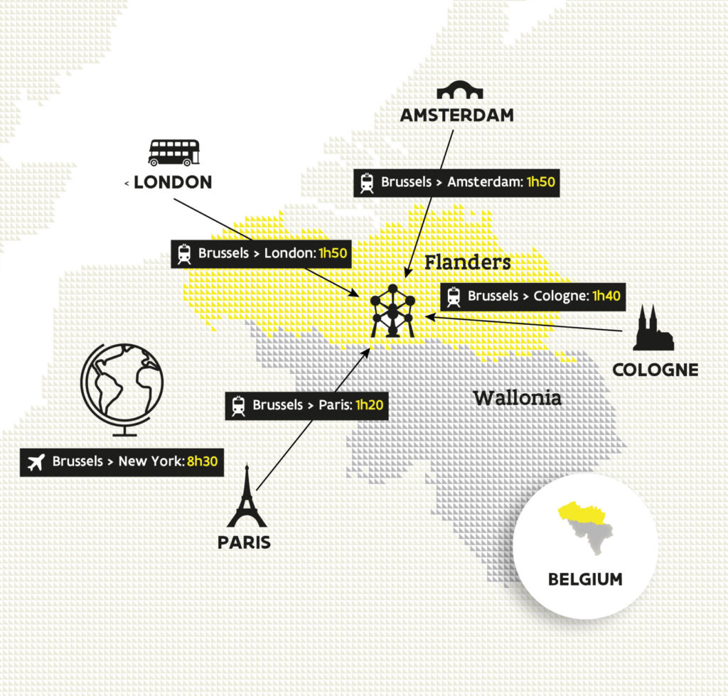
Oudenaarde sits in the heart of Flanders, about 30 km south of Ghent and within easy reach of all major Belgian cities. It’s directly connected by train to Brussels, Ghent and Kortrijk, which makes it a convenient base for exploring the region.
By train
- WeekdaysDirect train from Brussels Airport every hour (~1h12) • Two direct trains/hour from Brussels-Midi (~46–49 min)
- WeekendsVia Ghent: ~2h from Brussels Airport • ~1h24 from Brussels-Midi
Tip: buy tickets online and check live updates before you travel.
Approx. distances to Oudenaarde
- Ghent~30 km
- Brussels~60 km
- Antwerp~80–85 km
- Bruges~70 km
Getting to & around Flanders
Flanders is compact, well connected and easy to navigate. Use the short guides below to plan your trip and move smoothly between cities and regions.
Train & Public Transport
Major Flemish cities are typically under an hour apart by train. Within cities, buses and trams provide dense coverage with frequent services. Plan with the official providers: SNCB/NMBS (Belgian Rail), De Lijn (Flanders), STIB/MIVB (Brussels).
- Intercity trains connect key hubs; local services cover regional stops (tickets & railcards).
- In cities, trams and buses are ideal for short hops (De Lijn tickets, STIB/MIVB fares).
- Validate tickets as required and keep a digital copy handy.
Arriving by Air
Most international travelers arrive via Brussels and continue by rail or coach to Flemish destinations. Airport info: Brussels Airport. From the airport, trains run frequently to major cities (Airport train station).
Ferry Connections
Ferry routes to nearby ports (e.g., Calais, Dunkirk) offer an alternative to flying; onward travel into Flanders is typically by car or train. Check operators such as DFDS or P&O Ferries for timetables.
Driving & Parking
Motorways link cities efficiently. There is a large, free parking area just outside Hotel Leopold For local rules and zones, consult the respective city websites before you drive.
- Plan routes and parking in advance (consider P+R facilities).
- Switch to public transport for the last mile where convenient.
Cycling & Micromobility
Distances are short and cycling infrastructure is extensive. Wayfinding is clear, and many routes suit all levels. For last-mile options, consider bike sharing like Blue-bike.
- Use marked cycle routes and follow local traffic rules.
- Combine bike rides with train or tram where permitted.
Tickets, Passes & Practical Tips
Accessibility
Major stations and many vehicles offer step-free access. If you require assistance, arrange support ahead of time: SNCB assistance, De Lijn accessibility, STIB/MIVB accessibility.
Note: Always check current timetables, service updates and local regulations before you travel.